
Search a Lawrence Street Directory
Begin with the address exactly as it appears in the current Lawrence record. The useful sequence moves from the city parcel card to the map, then to the recorded deed, local register request, and historical address books. It does not turn five sources into one claim. The assessor may identify the city’s current owner and parcel key, a deed identifies recorded parties and legal land history, and a reverse directory can place a household at an address in a particular year. Each stage should retain its own date and source.
- Run the number, street name, and suffix through Lawrence Assessing Online. Copy the situs text, parcel or account number, owner field, mailing address, fiscal-year context, and any deed or plan reference.
- Open the linked MIMAP GIS view through the assessor route. Use the parcel polygon to orient the street segment, inspect nearby parcels, and follow the linked assessment record instead of relying on a map label.
- Search Northern Essex Registry records with the address, then preserve the town, date range, document type, party role, book and page or instrument number, and legal description from any result.
- For a dated local residence record, request the applicable Lawrence annual register from the Election Division. The statewide individual form is for a voter’s own status, not a street-wide search.
- Check a library reverse directory or house guide for the requested historical year. Record the printed address, directory year, page, and section before comparing it with a present parcel.
Negative results matter too. Note whether the portal was unavailable, the year was not indexed, the record was restricted, or the source was not held. That record of the search prevents a later researcher from mistaking an unavailable index for proof that no record exists.
Lawrence Street Directory Record Layers
Address-keyed sources in Lawrence form a chain, not a single list of everyone at an address. The assessor roll, MIMAP, and Registry all describe parcels or recorded land in different ways. Local voter registers and historical reverse volumes supply dated residence or address-listing evidence within their own rules. Inspectional Services material is address-linked too, but its exact historical online coverage is not published. Compare source dates before drawing a conclusion about a street.
| Address Record | Custodian | What It Can Show | Access Route |
|---|---|---|---|
| Parcel card | Lawrence Assessor | Current city owner field, situs, mailing, value, class, exemption, and assessment clues | VGSI online; Assessor Room 103, 200 Common Street; 978-620-3190 |
| Parcel map | MVPC and Lawrence MIMAP | Parcel geometry, nearby parcels, streets, layers, and linked assessment data | Public viewer linked from the assessor page; live controls need verification |
| Recorded instrument or plan | Northern Essex Registry of Deeds | Grantor, grantee, legal description, plan, recording date, and book/page or instrument reference | Online index and images; scanned indexes; Lawrence counter and public computers |
| Annual voter register | Lawrence Election Division | Name, residence, and permitted local voter fields for the requested year | Local office or public-record request; protected entries withheld |
| Permit or code record | Lawrence Inspectional Services | Address-linked permit, inspection, code, health, or license evidence when publicly available | Citizenserve route, counter, or specific records request |
| Reverse directory | Library and archives | Historic address-to-occupant listing | Reading room, microfilm, or selected digital years |
Use the parcel or account number to organize the city record, and use the legal description or plan reference when the street number is not stable. An owner field can lag behind a recent deed. A mailing address can be different from the parcel. A directory entry is a listing for its printed year. These differences are expected and should be preserved rather than reconciled by guesswork.
Lawrence Street Directory Assessor Fields
Lawrence Assessing Online is the starting portal for a present parcel connection. Its landing page confirms public property location, ownership, assessed value, and tax information. The city also says assessors review deed recordings, subdivisions, mergers, and building permits when updating ownership and valuation. Capture the result’s fiscal year and fields as displayed. The publicly reviewed static material does not expose every live search control or a full historical query range.
| Field or Control | Type | Use | Status or Limitation |
|---|---|---|---|
| Owner name | Text or autocomplete | Find a known owner’s public parcel connection | Live label needs confirmation |
| Street number and name | Address input | Locate the current parcel by address | Normalize spelling and suffix; live control needs confirmation |
| Parcel or account number | Text input | Use the strongest parcel key when known | Live label needs confirmation |
| Owner and mailing address | Result fields | Record the assessor’s administrative owner and tax-mail destination | Do not equate a mailing line with physical residence |
| Situs or location | Result field | Preserve the parcel’s physical address text | Keep separate from mailing address |
| Assessment and deed references | Result fields where shown | Record values, fiscal-year context, sale or deed reference, and history | Exact labels vary by rendered parcel card |
Assessed value is an administrative value, not a purchase price or a current market value. The FY2026 landing page identifies a value estimate date of January 1, 2025 and a sales-study period in 2024. The Assessor office is at Room 103, 200 Common Street, and is the counter fallback when the web card does not answer a precise parcel, field, or fiscal-year question.
Note: Copy the exact situs spelling and parcel key before changing systems, because the assessor, GIS, and Registry may use different update dates.
Lawrence Street Parcels in MIMAP
The City Assessor describes MIMAP as a public GIS and assessment-data application developed with the Merrimack Valley Planning Commission. It is most useful for walking a Lawrence street segment one parcel at a time. Search or locate the address, click the polygon, note the parcel identifier and address label, then use the linked assessment card for the city fields. Pan to nearby polygons only to understand the block pattern. Parcel outlines are not surveys, building footprints, or household boundaries.
The Lawrence Assessor page is the official route to the current MIMAP link. The static city material does not document a stable viewer URL, the live layer list, or every control. Check the rendered viewer before asserting a particular toggle, measure tool, or address filter. When a street number does not match a map label, retain the source text and compare the linked parcel card, deed plan, and historic street form.
Northern Essex Along a Lawrence Street
The Northern Essex Registry of Deeds keeps the recorded land trail for Lawrence, Andover, Methuen, and North Andover. Its document images begin in 1869. Ordinary recorded-land indexes begin in 1967, while scanned index images cover 1869 through 1979. Search results can identify parties, party roles, document type, recording date, town, legal description, and an image or book/page reference. A recorded deed speaks to land ownership and a transaction, not automatically to who occupied the address.
For a current street record, begin with number, street, suffix, and Lawrence. The Registry warns that address search is limited. When a result appears, preserve the town and date range and open the newest deed or instrument. Follow buyer and seller roles backward with the legal description, then compare the next earlier instrument. A subdivision, merge, plan, or registered-land parcel can require a plan or Land Court certificate/document search instead of a normal book-and-page route.
Lawrence Street Directory Index Recovery
A full address search that returns nothing is not the end of a Lawrence property trail. First widen the query to the street name, while retaining Lawrence as the town and recording the date range. Then move to the owner name, grantor or grantee role, book and page, year and instrument number, plan, or legal description. Older spellings, suffixes, and numbering can differ from current usage. The legal description often survives when a number does not.
The practical historical bridge is the scanned Northern Essex index for 1869 through 1979. Ordinary online recorded-land indexing reaches back only to 1967, even though images begin in 1869. For a 1869 to 1966 transaction, search the scanned index pages or use the Registry’s Lawrence counter and public computers. For an address older than 1869, the modern Registry district did not yet exist, so predecessor town or other historical repositories may be needed. Keep a dated research log of each failed and successful mode.
Lawrence Street Situs and Mailing Fields
Address records use different identifiers because each office has a different task. Normalize the current number, street name, and suffix, but retain the historic spelling exactly as shown in an old directory, atlas, or deed. Add the parcel or account number, lot or plan reference, postal city, and ZIP as separate fields. This avoids overwriting the source language when a historic address does not line up neatly with the present parcel card.
- Parcel
- A defined unit in the assessor or GIS system, usually linked to an account identifier and city assessment record.
- Situs address
- The physical location assigned to a parcel. It is different from the owner’s tax-mailing address.
- Plat or plan
- A recorded map or subdivision reference used to identify lots and boundaries when a street number is incomplete or later assigned.
- Criss-cross directory
- A reverse street section that lists addresses in order and can show the dated occupant or business association for that printed year.
Lawrence's record geography also changes by system. The city was formed from Methuen and Andover, while the Northern Essex Registry district still includes both communities and North Andover. USPS ZIPs, court locations, municipal parcels, and neighborhood labels have their own boundaries. A matching street name or postal label is not proof that every system refers to the same jurisdiction.
Lawrence Street Directory Register Requests
The local annual register is the by-street residence layer, not the Massachusetts statewide database. Under M.G.L. c. 51, § 37, the annual register is arranged alphabetically and places residence opposite a qualified voter’s name, subject to protective exceptions. Secretary guidance describes locally public fields such as name, address, party, date of birth, active or inactive status, and voter ID, with additional fields available in some records. Phone, email, protected-voter information, minors, and other confidential fields are not ordinary public list material.
Lawrence Voting & Elections identifies the Election Division at 200 Common Street, 978-620-3294. A useful request names Lawrence, the desired year, and a ward or precinct when known, then asks for the local annual register, street list, voter list, or other specified record in paper or electronic form. The Massachusetts Public Records Law provides a request route for public local material, but it does not require creation of a new index. The statewide central registry is not a public record and is not a substitute for a Lawrence request.
Note: Treat a public voter field as a dated record of registration, not proof that a person was physically present at a particular address.
Lawrence Street Permit Records
Permits and inspection records can add a dated property event to a Lawrence address trail. Inspectional Services handles building safety, structural certification, sanitary-code enforcement, food and measurement oversight, and permits, licenses, and certificates. The city routes permits, licenses, and report-a-concern contacts through Citizenserve. When a public result is available, preserve the address, permit number, type, status, date, applicant or contractor field, inspection result, and document link exactly as shown.
Older permit access needs a different route. The city’s public material does not state a universal historical online cutoff or complete search-field list. Ask the counter for the particular address and date range, or submit a precise public-record request to the responsible custodian. A permit applicant can be an owner, contractor, designer, or another authorized person, so that field must not be recast as a household record.
Lawrence Inspectional Services provides the official contact and service route for address-linked permit and inspection records.
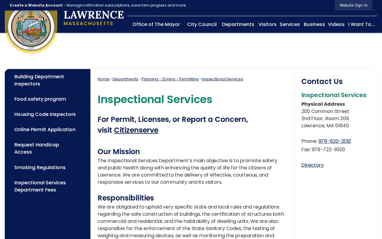
The service screen supports the address-record route, while the actual historical availability and fields must be confirmed on the live portal or with the city custodian.
Lawrence Street Directory Reverse Records
Historical reverse and house-guide directories help when the address is known but the surname is not. Massachusetts State Library references identify selected house-guide holdings for 1915 through 1969. Broader Lawrence directory bibliography covers various selected runs from 1847 through 1980. In the address section, record the directory title, publisher, year, page, printed street spelling, number, and household notation. OCR or a modern normalization should never replace the printed entry in a research note.
Lawrence Public Library Special Collections offers non-circulating local history material, city directories, and Eagle Tribune microfilm, with local-history materials and microfilm readers available in the building. Ask staff about the exact directory or reel year because a complete shelf inventory is not posted publicly. The historical collections and how to interpret an entry are covered in the Lawrence city directories resource, rather than treating a reverse listing as current information.
Lawrence Street and ZIP Geography
Street searches need a postal check when an address crosses a record boundary. Lawrence commonly uses ZIPs 01840 through 01843, but ZIPs are delivery geographies, not city-limit lines. Nearby 01844 Methuen and 01845 North Andover can appear in the same regional record context. The Registry district, municipal boundary, postal city, Census ZCTA, precinct, and parcel are separate fields. Use a USPS exact-address result for one current mailing ZIP rather than inferring it from a directory or a neighborhood label.
The city’s early industrial geography adds a historical wrinkle. Lawrence was formed from portions of Methuen and Andover, and early addresses can refer to streets, mills, canals, or community labels that do not match a modern map directly. The 1875 City Atlas, recorded plans, legal descriptions, city reports, and dated directories can help bridge the forms. No verified citywide street-renumbering chronology was located, so a renumbering date should not be assumed.
Lawrence Street Directory Privacy Limits
No public street source supplies a complete household roster. Owner fields, deed parties, voter records, permit applicants, and directory entries each have a limited purpose and date. The Massachusetts Address Confidentiality Program, protected-voter rules, sealed or impounded court material, juvenile information, DMV addresses, utility records, delivery data, and private association membership remain outside a normal street search. A request should name the particular public record and date range, not demand a combined dossier about a household.
Lawful use. Use Lawrence address records for personal, lawful research and civic questions. Do not use any result to stalk, harass, intimidate, or expose someone whose information is protected.
For a genuine record gap, use the right fallback: the assessor counter for parcel fields, the Registry counter or scanned index for old land records, the Election Division for a local annual-register request, Inspectional Services for an address-specific file, or the library for historical listings and microfilm. Those channels preserve the source boundaries that a street search cannot cross.
Note: Keep a separate date and source for each address result, because a consistent street line alone does not prove the same person or household.